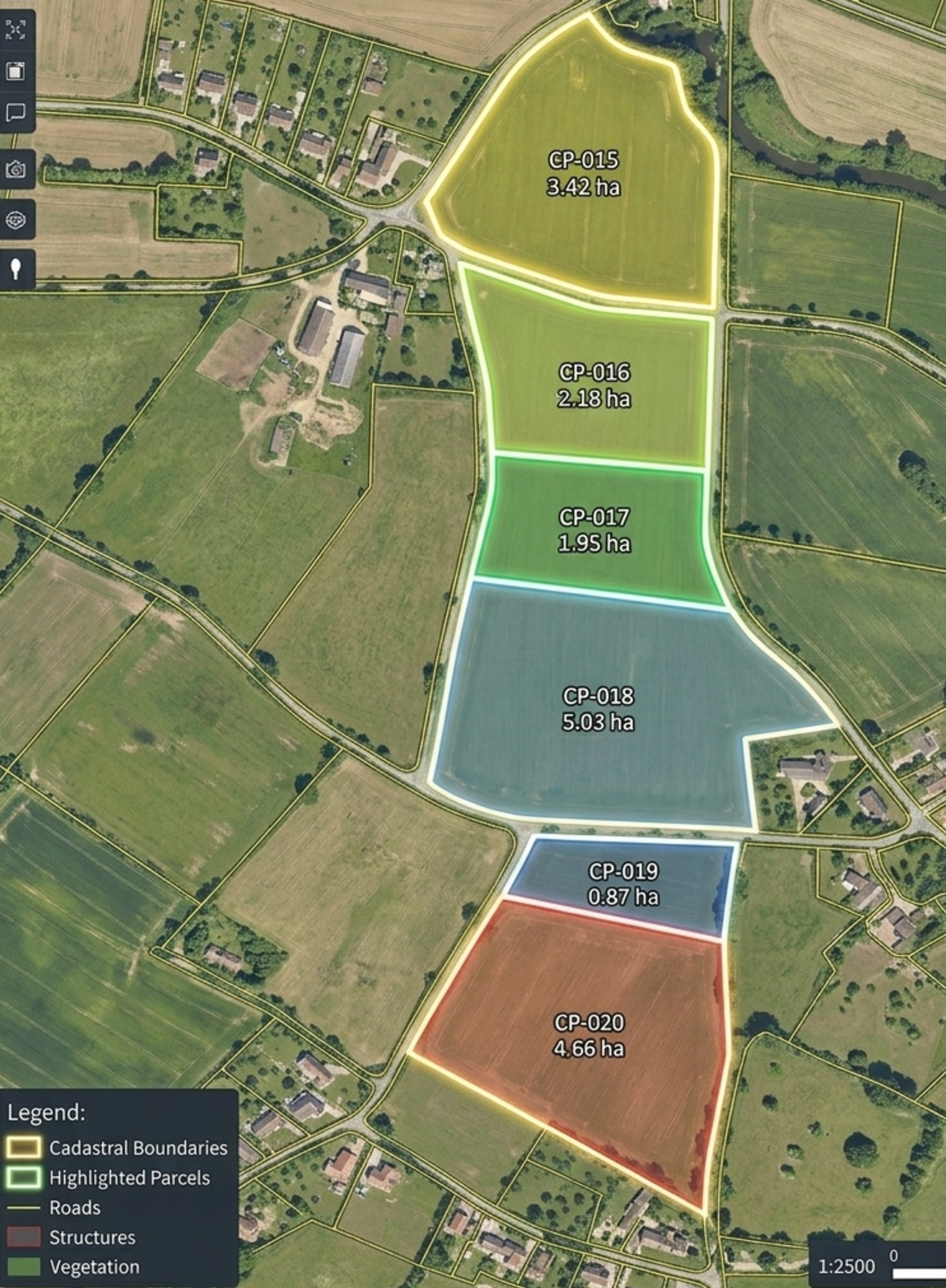
Boundary mapping, land parcel measurement, and revenue survey. Applications include property demarcation, encroachment detection, plot subdivision, and urban planning.
Tools Used
RTK/PPK, GCPs, Photogrammetry
Comprehensive monitoring including forest cover mapping, canopy density estimation, fire damage assessment, plantation tracking, and wildlife habitat mapping.
Sensors
RGB, Multispectral, Thermal, LiDAR
Precision agriculture offering crop health monitoring via NDVI maps, pest/disease detection, yield estimation, and sophisticated irrigation planning.
Benefits
Reduced Fertilizer, Early Stress Detection
Services include road alignment surveys, site progress monitoring, volume calculations (cut & fill), transmission line inspections, and railway corridor mapping.
Outputs
DSM, Orthomosaics, Contours, 3D Models

High-frequency monitoring for stockpile volume calculations, overburden measurements, expanding mine planning, and critical safety inspections.
Advantage
Faster, Safer, High-Frequency
Rapid response surveys for flood mapping, landslide assessments, earthquake damage analysis, and critical search & rescue operations.
Equipment
Thermal Drones & High-Res Sensors
Contact us to discuss your specific requirements. We offer tailored drone services to meet your unique needs.
Get a Quote