Exploring the benefits of drone technology in surveying
Explore Services
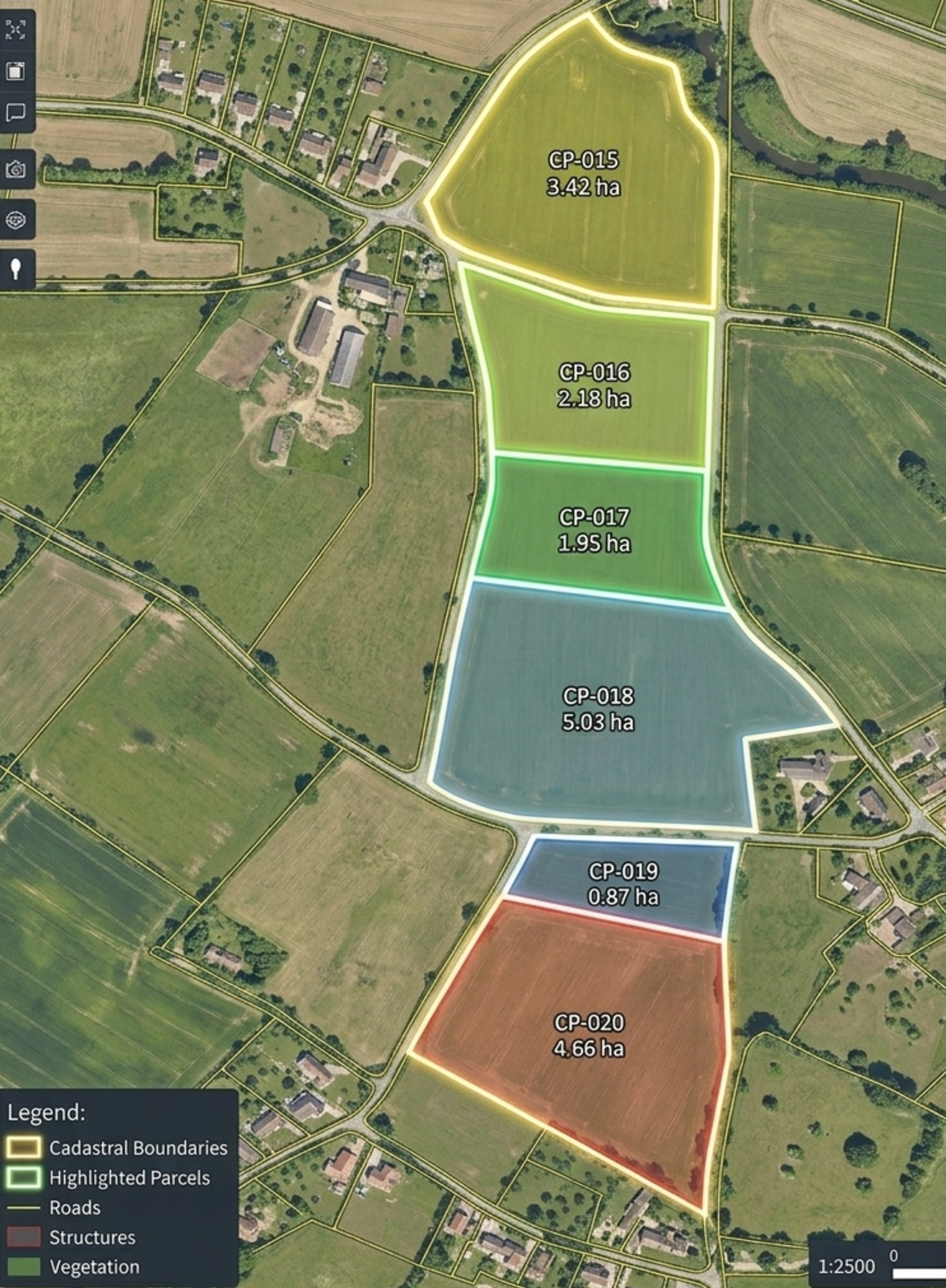
Boundary mapping, land parcel measurement, and revenue survey utilizing high-precision RTK/PPK drones and photogrammetry.
Road alignment surveys, progress monitoring, and volume calculations producing highly accurate 3D models and orthomosaics.
Leverage our reliable, high-performance aerospace solutions for your next commercial, industrial, research, or defense mission.
Explore ServicesTrusted By
Leading organisations across industries rely on VAYUPAKSHA AEROSPACE to power their aerial operations.